Downloadable Maps
Derby Trail Information - over 100 km of purpose built MTB single track
Individual Trail information starts half way down this page!
.
|
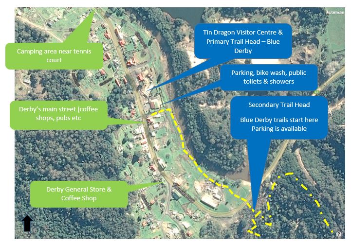
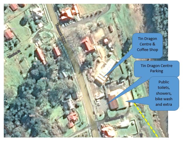
Below Crank It Cafe you will find the primary trail head. Primary trail head has showers (3 x $1) and toilets, a bike wash and heaps of parking. It also has a water tank for drinking water.
The camp ground near the tennis courts now has showers ($4 for 4 minutes) plus toilets. The first 20km-ish of trail build by World Trail opened on the 7 February 2015 and provides purpose built mountain bike singletrack. The next 10 km opened on the April 24 2015 and include's the iconic Dambusters trail. October 2015 saw the opening of Atlas, a shuttleable descent. In October 2016 the iconic 18km Blue Tier Trail opened, acclaimed by one and all as one of the best wilderness trails in the world. The secondary trail head is through town and near the bridge. No toilets at secondary trail head but has maps, ride routes and seating. Primary Trail Head
Toilets - yes Showers - yes ($1 x 3 for 4 minutes) Bike wash area - yes Bike Hire - yes (at the Tin Dragon Centre) Drinking Water - Yes OK and there is now a drinking water tank near toilets / shower facility. DO NOT DRINK water from creeks or streams! Trail Signage - yes - fan-bloody-tastic. Throughout the trails - everywhere! Trail Maps - yes, but ours are better! Parking - yes Shuttles - For the Blue Tier trail, Atlas & Black Stump Junction. See shuttles page Secondary Trail Head Only parking - no other services except Derby MTB clubrooms Maps - Yes, at secondary trail head. Other Public Facilities on Branxholm side of Derby, near tennis courts BBQ Public toilets Camping Showers - yes Mobile Coverage Telstra - yes - mostly good, including points on trails Boost Mobile - Yes - grab a prepaid if on one of the following, as they are a Telstra re seller Optus - no but yes at Branxholm through to Launceston, but patchy (includes Optus re-sellers) Vodafone - get a Telstra prepaid for your Tassie trip! Secondary Trail Head - No services
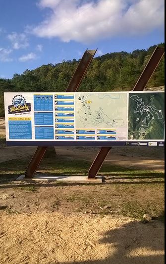
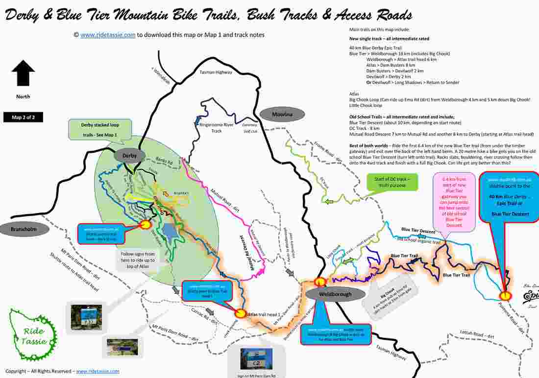
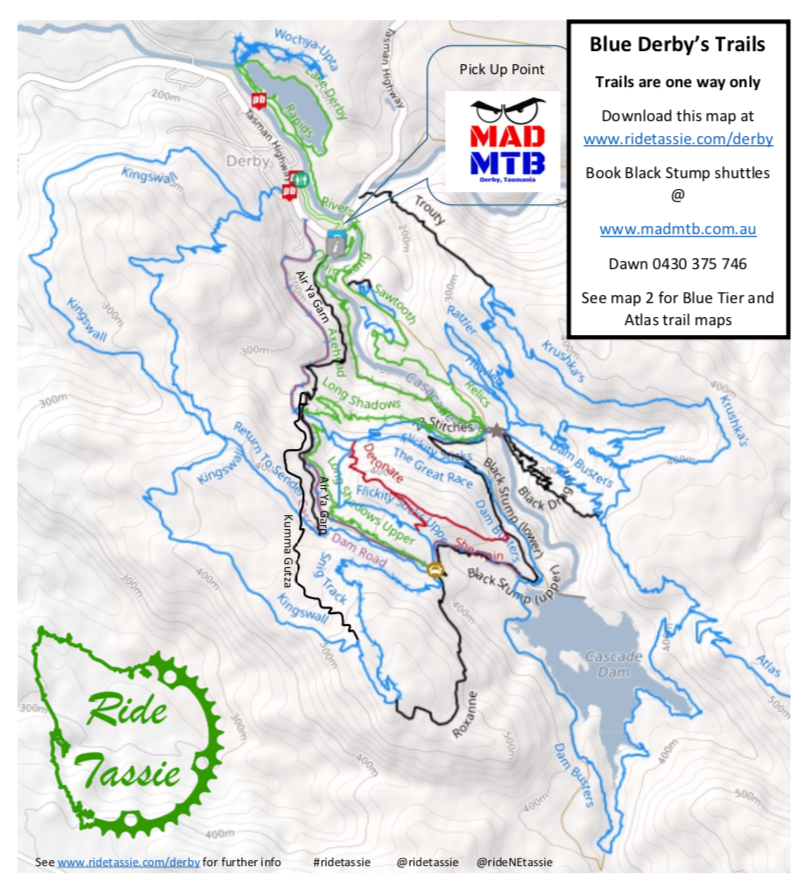
Not sure where the trails start? Good question. From the secondary trail head signs (see right image) head due south. You want to get on the trail Rusty Crusty and turn right onto Axehead. This will get you up to Devilwolf where most of the trails intersect.
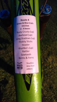
Grab a route cheat sheet to help guide you on your way. See right images and link |
Note - Secondary trail head above
Primary Trail Head including parking, water, public toilets, showers & bike wash
Signage at Secondary Trail Head
route cheat sheets at this link
|
Trail Notes & Maps
Note - To get up to the main trails, ride up Rusty Crusty and right onto Axehead.
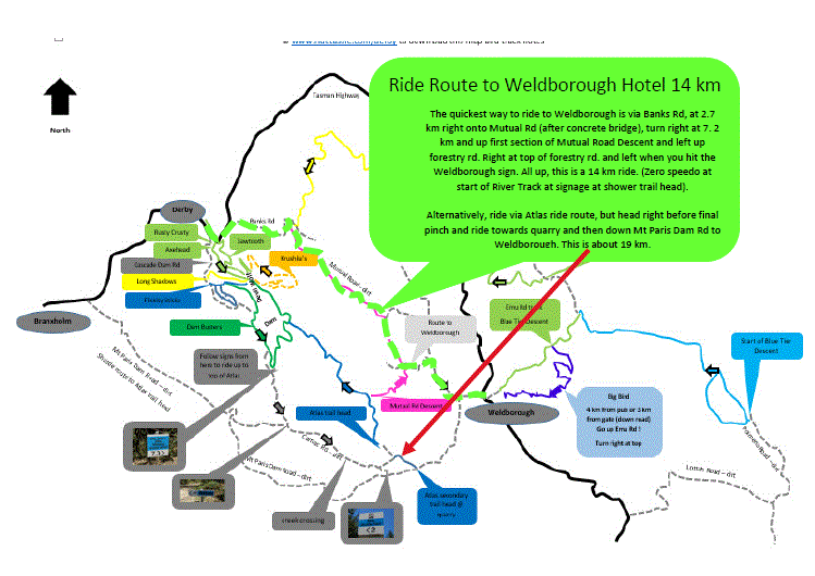
Please Note - Please map image is showing reverse to above map. Please do not get confused and note arrow direction of north. The below map is how you would use it when leaving the secondary trail head, where the big "Blue Derby" sign is (see photo below). Download it at this link
Individual Trail Notes
|
Rusty Crusty
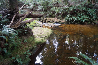
Departs from the secondary trailhead and climbs gently along the western bank of the Cascade River before crossing over the river and descending back to the trailhead. This trail provides a number of interesting granite slab features, as well as passing through the entrance of a disused tunnel that was constructed during the tin mining boom. The undulating and predominantly descending trail follows the eastern banks of the Cascade River. |
|
|
Axehead
Begins on the western bank of the Cascade River and is accessed via Rusty Crusty (see above). Climbing gently, this trail provides access to the Major Trail Junction (to Devilwolf) and spectacular views of a wide, open granite valley. Riders will then have the option to access other trails from here before rejoining Trail 1 near the tunnel entrance. |
|
|
Long Shadows is a smooth & gentle 1.5 km climb to help you get to the top of Flickity Sticks (see below). This trail suits beginners, as does Flickity Sticks.
Much of the trail follows the old mining water races, as it follow the contours of the hill side. Enjoy! |
|
|
Flickity Sticks
Flickity Sticks is an awesome little trail to get your body in tune with your bike and a great introduction to the trails. This is a 1.8 km descent that at first follows a mining water race and then goes down. It has great flow and meanders through the forest at a gentle rate. If ridden fast, it comes a little bit tricky, as the designers of the trail wanted. Most want to do it agian, straight away and if you have time, it's a great idea.. All obstacles can be rolled over and the trail has the best Return on Investment (ROI) for effort of all the trails in the area. You can also self shuttle to the top of Flickity Sticks if you feel the need. |
|
|
Kruska
This trail has spectacular views of the Cascade River, Ringarooma River, Mutual Valley and the township of Derby. You require some fitness to ride this trai as the first 30 minutes is up. It incorporates climbing sections designed to gain altitude with a bit of effort and descents that provide a roller coaster sensation. Natural rock features appear abundant throughout. What are you waiting for? |
|
|
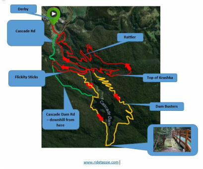
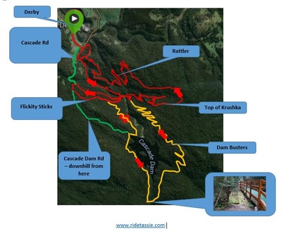
Dam Busters is one of the most popular 'cross country' trails at Derby. Its a great trail it you have progressed from beginner and have some fitness, although you can do a self shuttle (see map below). This is a great option if you don't have the fitness but want to enjoy the best of what Derby has to offer.
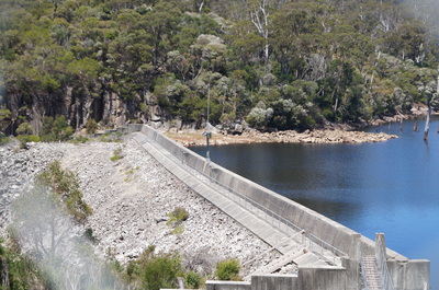
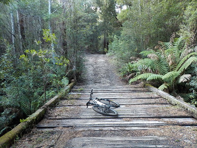
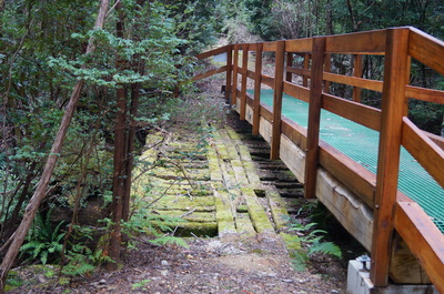
You can access Dam Busters 2 ways. 1. Axe Head > Long Shadow > and turn off 1/3 of way down Flickity Sticks. you then climb up Heartbreak Hill to the Cascade Dam Road. 2. Ride up Cascade Dam Road, with is just past the Federal Tavern. (This option is quicker and general easier. First 1 km is sealed and then it turns to dirt. As you past the Flickity Sticks trail junction, the road gets a little rough, but not too bad. If you go this way, it avoids Heart Break Hill and comes out near dam. See sign post at this junction. From here you follow Carnac Road, with is an old bush track that heads to Mt Paris Dam. A few km along you are then directed into some great single track that takes you along the Cascade River. You then pop out at the old wood bridge. Left is Dam Busters or follow the signs right up Carnac Rd to the top of Atlas trail (which is another 4.7 km from this point and has a few up sections, but is not too bad at all.) The remainder of the trail is single track, which circumnavigates the Cascade Dam. It provides spectacular views of the stunning Cascade River valley. It has a 2 main climbs, which require a bit of efforts. Be sure to stop and get a heap of selfies! |
|
Atlas 14 km from trail head to Derby (10 km just Atlas trail)
This trail can be ridden out and back (about 28 km) or 14 km one way if you shuttle. The ride out is along the Dambusters Route (see above) or via Cascade Dam Rd and then onto Carnac Rd (signposted from top of Dam Busters). Follow Dambusters route until you get to fancy wooden bridge and then go up road, following signs. Left at about 150 metres and follow attached route instructions, second page) Course is mainly enduro style with very little climbing. Seemingly never-ending berms take you from the start of the trail near Mount Paris Dam down to join into the Dambusters descent. The Atlas mine was one of Derby's famed tin mines, the relics of which still can be found hidden beneath the moss and ferns. it is an all out wilderness trail, mostly descending. One of the few point-to-point trails in the network that can be accessed by vehicle at the top. Atlas is a white-knuckle roller coaster ride that will appeal to more experienced riders. The boulders and mossy Myrtle Beech forests along the way create an experience not to be missed. |
|
|
Black Dragon
Black Dragon is a blue to black trail that could be very difficult if ridden with speed. It is a very tight trail that makes a relatively easy blue trail a little more difficult in places. See below video for more information. See video of Black Dragon here |
|
Big Chook via Weldborough Pub
|
Big Chook is the last stage of the Blue Tier section of Blue Derby. It is the first section to open in the Blue Tier Reserve with the remainder to open by October 2016.
Big Chook is a ripper 4 km descent with heaps of deep berms and jumps. The less adventurous can take b lines and roll over pretty much everything. To get to Big Chook, you can get there 2 ways. Directly via a 4 km ride from Weldborough Hotel or part of the Blue Derby Epic Trail. If you plan to just ride Big Chook, turn left straight after Weldborough Hotel and either park here (on left) or drive down 1 km to the bridge and start the 3 km climb up Emu Rd. At the top of the climb you are at Big Chook entry (turn right). |
|
New Blue Tier Trail
Disclaimer - The the term "Blue Derby" on this website is used to describe the location & intended nominative uses rather than to imply a relationship or endorsement with the TM owner

