Information on Tasmania mountain bike trails, tracks including maps on Tassie, Blue Derby,
  • Home
  • About RT
  • Getting to Tassie
  • North West Tassie
    • Kelsey Tier
    • Wild Mersey
    • Dial Range
    • Climies Track
    • Montezuma Falls
    • Zeehan Trails
    • Queenstown MTB Park
  • Southern Tassie
    • SouthShuttles
    • Maydena
    • Clarence Meehan Range
    • Glenorchy MTB Park
    • Mt Wellington Trails
    • North South Track
    • South More
  • North East Tassie
    • Launceston
    • Hollybank
    • Georgetown
    • Derby >
      • Blue Derby maps
    • North East Shuttles
    • Blue Derby Airport Transfer
    • Blue Tier
    • St Helens >
      • St Helens Shuttles
    • Other NE Rides
  • Tours
  • What to bring
  • Mobile Phone Coverage
  • Tassie Free Wifi Hotspots
  • Bike Hire & Shops
  • Tassie Weather Forcasts
  • Tassie Past Rainfall
  • Tassie Websites
  • Public toilets
  • Credits
  • Contact
  • Bike Trailer Hire
  • Blue Derby Video Blogs
Montezuma Falls - Home

Montezuma Falls - Trail Info

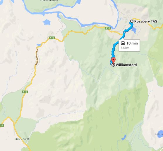
Address - Williamsford Carpark - From Rosebery travel 2 km south and then turn left onto Williamsford Rd. Travel a further 4.5 km to Williamsford Carpark.

Toilets - Nope, Public toilets in Rosebery & Zeehan

Trail Head Services
Nil at trail head but shops only 10 minutes drive - Rosebery

Car Travel Times
Burnie > Rosebery - 90 minutes
Launceston > Rosebery - 3 1/2 hours (via Cradle Mountain)

Services 
In Rosebery. Bugger all in Zeehan apart from a supermarket, pubs and accommodation and a cool museum!

Nearest Bike Shops
Burnie

Mobile Reception
Telstra
Optus - nope!


More trail notes & info at this link.
Picture
Picture
Picture
Picture
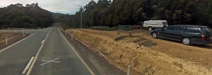
Junction of Murchison Hwy and Montezuma Falls Track
Powered by Create your own unique website with customizable templates.