Information on Tasmania mountain bike trails, tracks including maps on Tassie, Blue Derby,
  • Home
  • About RT
  • Getting to Tassie
  • North West Tassie
    • Kelsey Tier
    • Wild Mersey
    • Dial Range
    • Climies Track
    • Montezuma Falls
    • Zeehan Trails
    • Queenstown MTB Park
  • Southern Tassie
    • SouthShuttles
    • Maydena
    • Clarence Meehan Range
    • Glenorchy MTB Park
    • Mt Wellington Trails
    • North South Track
    • South More
  • North East Tassie
    • Launceston
    • Hollybank
    • Georgetown
    • Derby >
      • Blue Derby maps
    • North East Shuttles
    • Blue Derby Airport Transfer
    • Blue Tier
    • St Helens >
      • St Helens Shuttles
    • Other NE Rides
  • Tours
  • What to bring
  • Mobile Phone Coverage
  • Tassie Free Wifi Hotspots
  • Bike Hire & Shops
  • Tassie Weather Forcasts
  • Tassie Past Rainfall
  • Tassie Websites
  • Public toilets
  • Credits
  • Contact
  • Bike Trailer Hire
  • Blue Derby Video Blogs

Credits

All efforts have been made to contact copyright owners. If you feel content on this website is not attributed correctly, please contact us. 


This website is not possible without the ongoing support of the following people or organisations.

www.tassietrails.org

http://www.tassierambler.org/

Picture


North-South Track image


Simon Townsend & Kath Bicknel


Picture


Blue Tier photos 

Hamish Johns
Picture


Dirt Art


Plus photos of Hollybank trails
Picture
Derby / Weldborough / Blue Tier topographical maps

www.tasmaps.tas.gov.au 


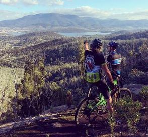
Dirt Art

Meehan Range, looking to Hobart and Mt Wellington.

Troy from Over the Edge Sports in the US. June 2014

Dirt Art's Facebook page
Picture


Meehan Range switchbacks

From Meehan Monster crew

Ride Bellerieve and Osborne Images
Picture
Powered by Create your own unique website with customizable templates.