Information on Tasmania mountain bike trails, tracks including maps on Tassie, Blue Derby,
  • Home
  • About RT
  • Getting to Tassie
  • North West Tassie
    • Kelsey Tier
    • Wild Mersey
    • Dial Range
    • Climies Track
    • Montezuma Falls
    • Zeehan Trails
    • Queenstown MTB Park
  • Southern Tassie
    • SouthShuttles
    • Maydena
    • Clarence Meehan Range
    • Glenorchy MTB Park
    • Mt Wellington Trails
    • North South Track
    • South More
  • North East Tassie
    • Launceston
    • Hollybank
    • Georgetown
    • Derby >
      • Blue Derby maps
    • North East Shuttles
    • Blue Derby Airport Transfer
    • Blue Tier
    • St Helens >
      • St Helens Shuttles
    • Other NE Rides
  • Tours
  • What to bring
  • Mobile Phone Coverage
  • Tassie Free Wifi Hotspots
  • Bike Hire & Shops
  • Tassie Weather Forcasts
  • Tassie Past Rainfall
  • Tassie Websites
  • Public toilets
  • Credits
  • Contact
  • Bike Trailer Hire
  • Blue Derby Video Blogs
Dial Range - Home

Penguin MTB Park / Dial Range Trail Info

Trail Head Services
Nil at trail head but shops only 5 - 10 minutes ride away, in Penguin 


Toilets - No. Public toilets in Penguin township

Car Travel Times
Launceston > Penguin 90 minutes with no stops - map

Hobart > Penguin 3 1/2 hours with no stops

Services 
Heaps in Penguin, Burnie and Devonport 

Nearest Bike Shops
Ulverstone - see North West Bike Shops

Mobile Reception
Telstra
Optus - not much

Vodafone - who? 
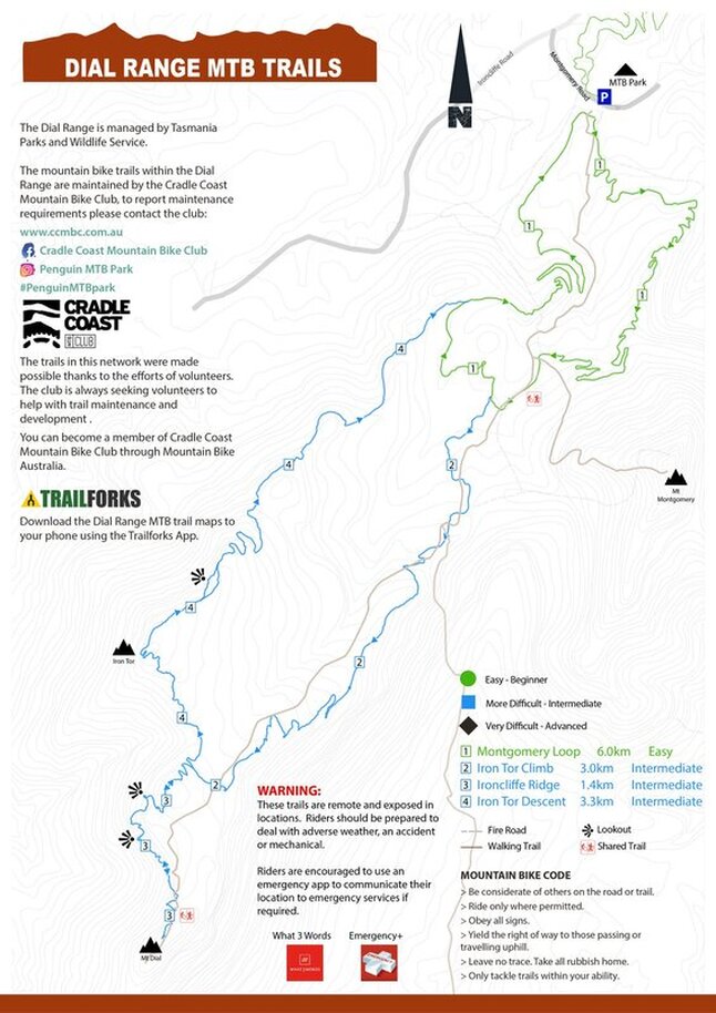
Picture
Dial Range on Trailforks.com
Penguin MTB Park
Address - southern side of Ironcliffe Rd and Sports Complex Avenue - map

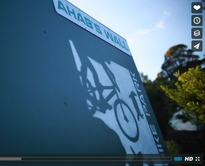
park consists of 15 km of single track and an awesome skills area.

Park is home to the Cradle Coast Mountain Bike Club
Video source - Next Level Mountain Bike
Picture
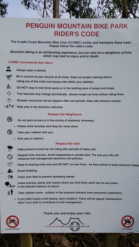
image - Chris Stredwick
Picture
Picture
Powered by Create your own unique website with customizable templates.