
Sentry Page Protection
Hollybank Home
Hollybank Trail Info
.
|
Please note - A 125 mm or 180 mm travel dually is best to get the most out of the Juggernaut trail. 100 mm is ok.
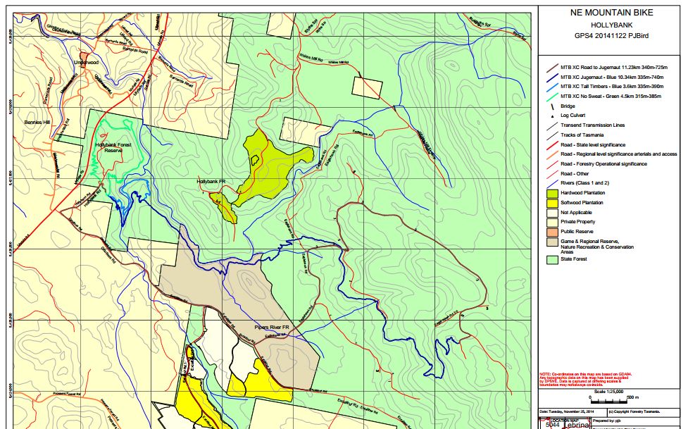
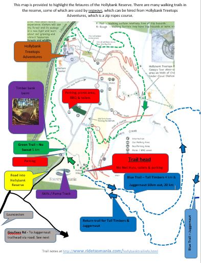
Hollybank trails cover over 20 km of trail, from sweet flowing beginners tracks (Track 1) to gnarly rocky rock drops (track 4&5) . Due to the location there are excellent opportunities for car shuttles that allow for 10 km descents. Trail Head / Parking - As you enter the Hollybank Reserve, you'll notice the skills area / pump track on the right. Parking is to the next right side, which is the trail head and map hut. Toilets to right near McNeil huts or drive straight through to Cricket Pitch picnic area. Caution - Segways use walking paths that cross MTB trails (mainly green trails) so caution advised when crossing tracks. Trails include;
Getting to the top of Juggernaut Juggernaut is a 10 km ride, with the last 4 km UP. An alternative is to either ride via the road or have a few mates and shuttle to the top. Short cut shuttle map. Below bike sign marks shuttle road to top of Juggernaut (10km drive) Road directions to get to the top Juggernaut trail. 
Most blue / black trail riders will mainly ride the top 4 km of Juggernaut and shuttle back up this section. This is easy to do as the trail cross the road at a few key places.
Map of Hollybank MTB trails and walking tracks at this link and road directions to get to the top Juggernaut trail. Top 4km of Juggernaut shuttle map here Shuttle - Yes - see Hollybank Shuttles page |

|
Skills Area / Pump TrackOn right hand side as you enter Hollybank Reserve.
|
|
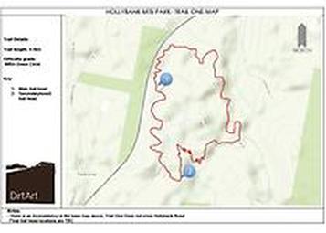
Trail 1Trail name - No Sweat
Distance - 5km Surface - Gravel capped Difficulty - Green / Beginner Overview- No Sweat has been designed and built from the ground up to provide the perfect introduction to mountain biking. The trail has been gravel surfaced to provide a year round, all weather riding experience. Packed with gentle flow, the trail features endless berms and rollers through an iconic and highly varied forest environment. Absolute beginner or seasoned professional, you'll love No Sweat. Track notes to come and high quality maps. Park in car park to left as you make your way past the gates into Hollybank. Right of this are the McNeil huts and toilets Words from Dirt Art |
|
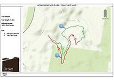
Trail 2Trail name - Tall Timbers
Distance- 4km Surface- Natural (hero dirt!) Difficulty- Blue Square/intermediate Overview- Tall Timbers is a stunning 4km ride full of natural flow and rock. Beginning with the giant descending berms of 'The Corkscrew' the trail ducks and weaves through stunning native forests and includes two river crossings. The trail is an intermediate ride that is designed to be a natural progression from No Sweat. Track notes to come and high quality maps words from Dirt Art Facebook page |
|
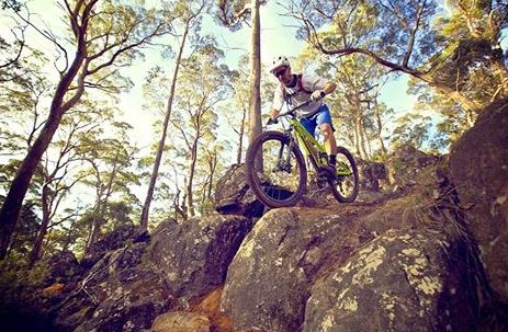
Trail 3Trail name- Juggernaut
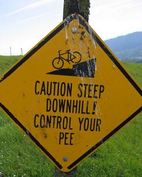
Distance- 10km Surface- Natural Difficulty- Blue Square/intermediate Overview- Featuring over 6km of all out descending, and a further 4km of gradually descending this trail is already being hailed as one of Australia's best. With the ability to shuttle to the summit (self-shuttles at this stage), this trail provides a unique all-mountain (so enduro!) experience featuring a relentless mix of natural rock technicality and tyre-rolling berms and flow. From open rocky peaks offering stunning vistas, through to brooding, dark forests, Juggernaut is a journey through multiple unique Tasmanian forest types and terrain. PS. This is harder than you think! It's not just a roll down a hill..... words by Dirt Art Shuttle - Yes - see Hollybank Shuttles page Map and directions to Juggernaut Trail Head |
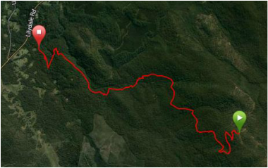
Shuttle / Trail head road rout_e map at this link
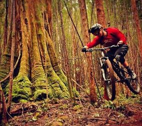
Image Dirt Art
|
|
Trail name- Ginger Ridge
Distance - 1km Surface - Natural Difficulty- Double Black Diamond/Extreme Overview- Ginger Ridge is an existing trail that we have given a little love. Built some years ago by local Rob Potter the trail is a frenzy of steep rock chutes, drops and turns. Suitable only for advanced riders this hand-built trail offers a truly challenging descent suitable for all mountain and downhill riders. The trail connects back onto Juggernaut via a 2km commute, or may be shuttle independently using Juggernaut as a lead-in from the summit with a pick up at the trails end. words by Dirt Art |
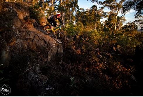
Thanks Hajos Photos for the image
|
|
Trail name - Reverb
Distance- 0.3km Surface- Natural rock slabs Difficulty- Double Black Diamond/Extreme Overview - Reverb is not for the faint hearted, offering arguably the most challenging descent at Holybank. The short link provides an alternative diversion from Juggernaut, suitable only for highly advanced riders. This steep trail is littered with unavoidable drops and very steep rock chutes. For those with the requisite skill and commitment, this is one seriously fun trail! words by Dirt Art Maps of Hollybank and shuttle routeTassieTrail.org track notes on Hollybank |
|
